By Dan and Lisa Goy from the May 2018 Edition
February 7 – 10, 2016 (Day 32-35)
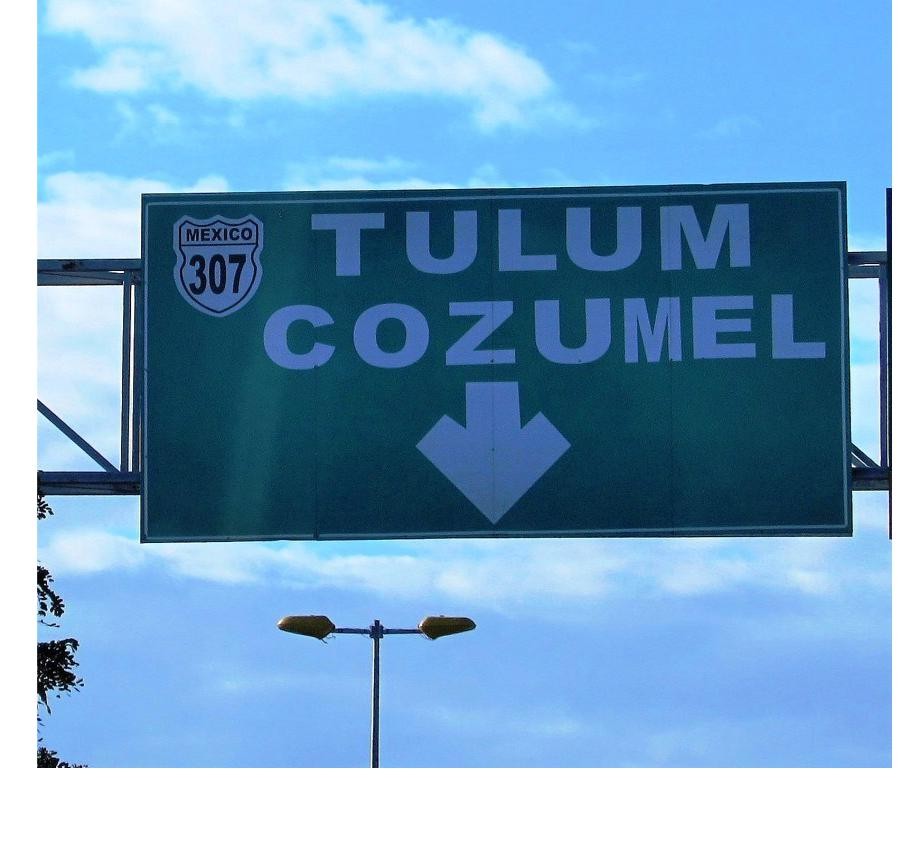
Sunday morning, we were southbound on Hwy 307 to the Mayan Riviera to take a look at 3 potential camping spots for 3 or 4 days. This was a short drive of less then 100 km or 60 miles. It was a great road and easy drive. Rafael had phoned ahead with 2 possible locations that both confirmed they had room for all 6 RVs. One location was $300 pesos per day (XpuHa Campground), the other $47.25 USD or $850 per day (Paa Mul RV and Cabañas).
by Dan and Lisa Goy, exclusive to Manzanillo Sun
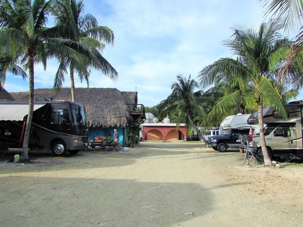
When we arrived at Acamaya Reef, we parked at the PEMEX across the street which was very handy. Then Rafael, Eileen and Dan went to see what was what. We had been unable to con-tact campground #1. Acamaya Reef Motel, Cabañas and RV Park was a no go, just no room. Campground #2, (Xpu-Ha) at $300 pesos per night, already had 8 RVs and the layout was problematic, to say the least, so we decided on the expensive option, Paa Mal RV Park. In many ways, this park reminds me of Loreto Shores in Loreto on Baja, expensive with the real fo-cus on permanentes.
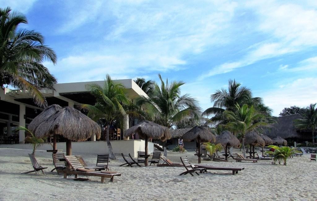
With 200 sites, only about 20 or so remain for travelling RVs. The rest were occupied by full time residents who had built palapas around their motorhomes, travel trailers and 5th wheels. Apparently to maintain their status as a campground (including tax breaks), they need to have actual RV spaces that are availa-ble for daily use. So far on this tour we have found the camping fees to be less than on Baja. Isla Aguada and Paa Mal are the exception. It is not surprising that the waterfront was occupied by permanent structures years ago, and also appears a low rise hotel was added more recently.
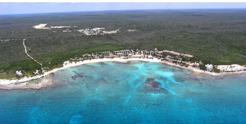
The actual RV sites that were available were OK, 30 amps, fairly level, in a rack and pack fashion. However, the washrooms available were brutal. The women’s was closed, the men’s should have been closed. Sad, considering they charge almost $50 USD per day. The good news was the folks we met were friendly, the beach very attractive and swimmable. There was a nice pool and restaurant that had much cleaner washrooms.
I used the outside pool shower to wash my hair and soap down. I left my bathing suit on given the onlookers poolside and in the restaurant. Just one more negative to mention. Wifi was available, but only to those staying in the hotel or cabañas.
No access to the internet was avaz`ilable, even for an extra fee. We checked out the restaurant for dinner; the food was good, beer cold and reasonably priced.
Day 2 at Paa Mal saw many in the group take a colectivo to a beach further south where they could swim with turtles and rays in the sea grass. We headed to the beach at the park with Mike and Kelly, did some swimming and paddle boarding. The sun was out most of the time with some breeze. It was very pleasant.
Day 3 we started with breakfast at the restaurant then the gang drove into Playa del Carmen. Eileen and Rafael met her sister and husband, following for a vacation. The rest of the gang just walked about and took in the sights.
We had had never been anywhere on the Caribbean coast, so all was new. We found a small local eatery a few blocks from the tourist zone, lots of Mexicans, not many foreigners. It was very reasonably priced, well under 200 pesos for the two of us.
Day 4 in Paa Mul many of us headed to Tulum, the Mayan Ar-cheological site on the Caribbean, one of what is referred to as the “Big 4” (Uxmal, Chichen Itza, Tulum and Palenque). Alt-hough the site was very scenic and manicured (it seemed like a golf course) I was underwhelmed in general. Good news was no merchants on the site itself and did find a bumper sticker thanks to Mike. Back to the RV Park for some sun, swimming, fun and, of course, a happy hour.
Playa del Carmen
Playa del Carmen is located along the Caribbean Sea in the municipality of Solidaridad, in the state of Quintana Roo, Mexico. It is a very popular tourist area in eastern Mexico. Playa del Carmen features a wide array of tourist activities due to its ge-ographical location in the Riviera Maya. It has also been the destination of PGA Tour golf tournaments and the set location for various television shows. The town has become one of the fastest to grow in population size in Mexico.
Playa del Carmen is located within the Riviera Maya, which runs from south of Cancún to Tulum and the Sian Ka’an biosphere reserve. Playa is a stop for several cruise ships which dock at the nearby Calica quarry docks, about six miles (10 km) south of the city. The Xcaret Eco Park, a Mexican-themed “eco-archaeological park”, is a popular tourist destination located just south of the town in Xcaret.
In October 2005, Hurricane Wilma passed directly over Playa del Carmen, remaining in the vicinity for two days and causing significant damage and a temporary drop in tourist arrivals.
Most of the damage was relatively superficial and repaired within a few weeks of the storm. Hurricane Wilma arrived from the Caribbean Sea, passing over Cozumel before making land-fall in Playa del Carmen. It then moved north along the Mexi-can coast, hitting Cancún especially hard.
Originally a small fishing town (like Cabo San Lucas), tourism to Playa del Carmen began with the passenger ferry service to Cozumel, an island across the Cozumel Channel and a world-famous scuba diving destination. Playa del Carmen has recently undergone extreme rapid development with new luxury residential condominium buildings, restaurants, boutiques and entertainment venues. Tourist activity in Playa del Carmen centers on Quinta Avenida, or Fifth Avenue, which stretches from Calle 1 norte to Calle 40. A pedestrian walkway located just one or two blocks inland from the beach, Fifth Avenue is lined with hundreds of shops, bars and restaurants. There are many small boutique hotels on and just off Fifth Avenue and on the beach.
Playacar is a residential and tourist development in Playa del Carmen just south of the main urban area. Most of the all-inclusive hotels, the aviary and the golf course are located in this development. There are two phases – phase 1 is mostly residential with a few hotels and some stores, while phase 2 contains the largest all-inclusive resorts as well as the golf course and a significant number of residential properties.
The city is home to Inter Playa del Carmen, an association foot-ball club founded in 1999, which competes in the south group of the Segunda División Profesional, the third tier of Mexican Tulum
Tulum is the site of a pre-Columbian Mayan walled city serving as a major port for Cobá, in the Mexican state of Quintana Roo. The ruins are situated on 12-meter (39 ft) tall cliffs along the east coast of the Yucatán Peninsula on the Caribbean Sea in the state of Quintana Roo, Mexico. Tulum was one of the last cities built and inhabited by the Maya; it was at its height between the 13th and 15th centuries and managed to survive about 70 years after the Spanish began occupying Mexico. Old World diseases brought by the Spanish settlers appear to have resulted in very high fatalities, disrupting the society and eventually causing the city to be abandoned. One of the best preserved coastal Maya sites, Tulum is today a popular site for tourists.
This Maya site may formerly have been known by the name Zama, meaning City of Dawn, because it faces the sunrise. Tulum stands on a bluff facing east toward the Caribbean Sea. Tulum is also the Yucatan Mayan word for fence, wall or trench. The walls surrounding the site allowed the Tulum fort to be defend-ed against invasions. Tulum had access to both land and sea trade routes, making it an important trade hub, especially for obsidian.
From numerous depictions in murals and other works around the site, Tulum appears to have been an important site for the worship of the Diving or Descending god. Tulum was first men-tioned by Juan Díaz, a member of Juan de Grijalva’s Spanish expedition of 1518, the first Europeans to spot Tulum. The first detailed description of the ruins was published by John Lloyd Stephens and Frederick Catherwood in 1843 in the book Inci-dents of Travel in Yucatan. As they arrived from the sea, Ste-phens and Catherwood first saw a tall building that impressed them greatly, most likely the great Castillo of the site. They made accurate maps of the site’s walls, and Catherwood made sketches of the Castillo and several other buildings. Stephens and Catherwood also reported an early classic stele at the site,
with an inscribed date of AD 564 (now in the British Museum’s collection). This has been interpreted as meaning that the stele was likely built elsewhere and brought to Tulum to be reused. Work conducted at Tulum continued with that of Sylvanus
Morley and George P. Howe, beginning in 1913. They worked to restore and open the public beaches. The work was contin-ued by the Carnegie Institution from 1916 to 1922, Samuel Lo-throp in 1924 who also mapped the site, Miguel Ángel Fernán-dez in the late 1930s and early 1940s, William Sanders in 1956, and then later in the 1970s by Arthur G. Miller.
Both coastal and land routes converged at Tulum and a num-ber of artifacts found in or near the site show contacts with ar-eas all over Central Mexico and Central America. Copper arti-facts from the Mexican highlands have been found near the site, as have flint artifacts, ceramics, incense burners, and gold objects from all over the Yucatán. Salt and textiles were among some of the goods brought by traders to Tulum by sea that would be dispersed inland. Typical exported goods included feathers and copper objects that came from inland sources. These goods could be transported by sea to rivers such as the Río Motagua and the Río Usumacincta/Pasión system, which could be traveled inland, giving seafaring canoes access to both the highlands and the lowlands.
The Río Motagua starts from the highlands of Guatemala and empties into the Caribbean. The Río Pasión/Ucamacincta river system also originates in the Guatemalan highlands and emp-ties into the Gulf of Mexico. It may have been one of these seafaring canoes that Christopher Columbus first encountered off the shores of the Bay Islands of Honduras. Jade and obsidian appear to be some of the more valuable found here.
The obsidian would have been brought from Ixtepeque in northern Guatemala, which was nearly 700 kilometers (430 mi)
away from Tulum. This huge distance, coupled with the density of obsidian found at the site, show that Tulum was a major center for the trading of obsidian.
This beach at Tulum is protected for nesting sea turtles; Quintana Roo, Mexico. Tulum archaeological site is relatively compact compared with many other Maya sites in the vicinity and is one of the best-preserved coastal Maya sites. Its proximity to the modern tourism developments along the Mexican Caribbe-an coastline and its short distance from Cancún and the surrounding “Riviera Maya” has made it a popular Maya tourist site in the Yucatan. Daily tour buses bring a constant stream of visitors to the site.
A word to the wise: Paa mul Beach
• This is a sandy beach with some exposed limestone
• Footwear is required in most water entry areas
• There’s more sand on the south side of the beach for easier water entry
• Snorkeling and swimming are recommended when the seas are calm
However, it’s really the offshore coral reef that remains among the most breathtaking and well-preserved attractions on the Paa mul beach. Zigzagging through the crystalline waters of the Caribbean close to the shore, the reef can easily be explored.
Download the full edition or view it online
Dan and Lisa Goy, owners of Baja Amigos RV Caravan Tours, have been making Mexico their second home for more than 30 years and love to introduce Mexico to newcomers.