By Dan and Lisa Goy from the June 2018 Edition
January 6-7, 2016 (Day 0-1)
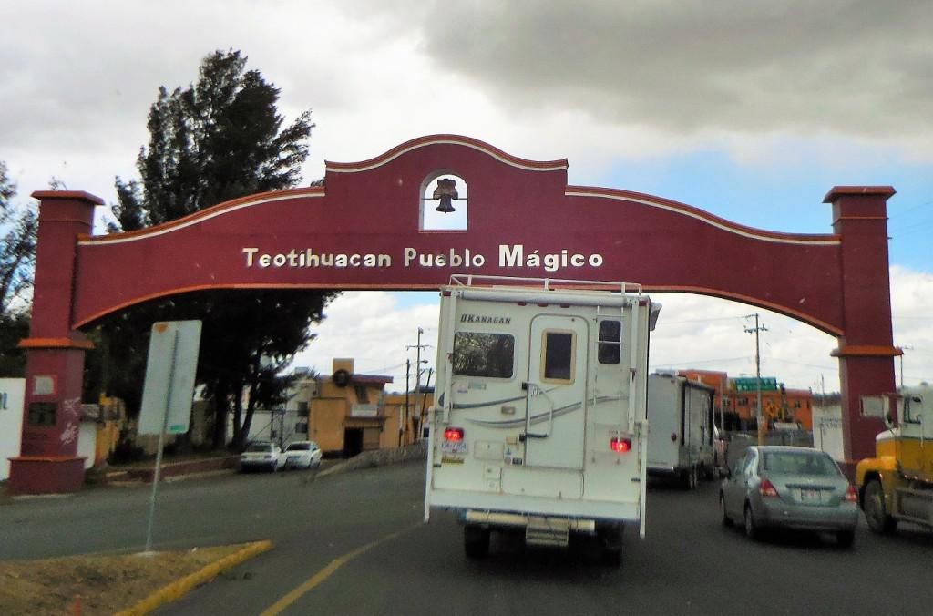
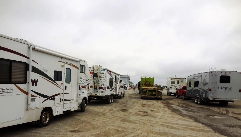
We selected Pharr, TX and the Tropic Star RV Park as our rendezvous location for our 90 Day Mexican Adventure. Great spot to shop prior to departure and a decent RV Park. We had made arrangements to take Lulu to Petco for a trim and shampoo near San Antonio, however they informed us the Canadian rabies documentation was not acceptable, US shots only! Good enough to bring the dog into the country, but not for a haircut at Petco. We did find a wonderful young gal referred by the Pharr RV Park to do the job. Our group of Canadians and Americans got together later for a happy hour, excited about our Mexican Adventure. We knew the next 2 days of travel through Tamaulipas had a negative reputation, however we also knew we would trade anxiety for the wondrous sites and Mexican experiences. We really do have a wonderful group and are really looking ahead to sharing our adventure with all of them.
We crossed, as planned, early in the morning of January 7th at Pharr, Texas, into the state of Tamaulipas, one of Mike and Terri Church’s recommended crossings. The Mexican border officials put all our RVs through an X-ray and parked us for the results. We decided to use this time to do all the paperwork required for tourist permits and vehicle import permits. This is always a fascinating process of personal immersion in a Latin American bureaucracy. We were first in line as we had our 6 month tourist permits from Tecate, Baja California. Would these be acceptable? We know by law they are not multiple entry permits, we also know there are lots of laws at the Mexican border that are rarely enforced.
We were happy to see the Banjercito (Bank), copy center and Inmigrado (Immigration Office) were all in one large office space. Our first encounter was the Banjercito to arrange for our vehicle permit. The teller looked at our copies, saw that we had a Tourist Permit from Tecate dated November 6th, 2015 and sent us to another person (at the copy center). There we were told we would need to see the inmigrado officer, who would issue us a new tourist permit for the 4 months remaining on our current tourist permit. Moving to our 3rd line, the inmigrado officer looked at our tourist permit and determined we required nothing as our permits still had 4 months left, so we got back into the original bank line. This only took 20 minutes. All of the folks we spoke to never actually talked to each other. The same teller we started with seemed satisfied we had met all the immigration issues and processed our Temporary Vehicle Import Permits, $59 each, plus a $400 USD deposit. No pesos please, US Funds only, cash or credit card. We were all finished and back into the vehicles by 9:50 am (we left the campground at 7:30 am), had the green light from the X-ray, no further inspection required. Yes, we were on our way!
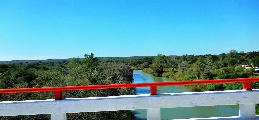
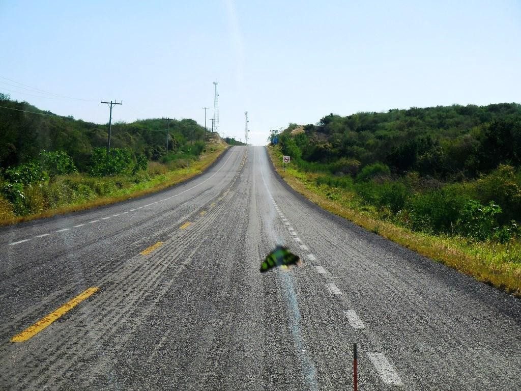
We had originally planned to visit Ciudad Victoria as our first stop, however, given some security concerns, we took a pass and drove directly towards Tampico, 535 km (330 miles). This was a long day for sure, about 8 hours of driving. We arrived at the Country Express Hotel in Altamira, (just north of Tampico), about 4:40 pm, with lots of daylight left, but we were tired. Along the way, we encountered a lot of very good road and lots of new scenery. Dry camping behind the motel was only $100 pesos. Dinner at the restaurant was $285 pesos and the WiFi worked well for those who went to the lobby. Some truckers came and went. All was good and we slept well on our first night in Mexico.
Pharr is in Hidalgo County, Texas, United States and the city limits extend south in a narrow band to the Rio Grande and the Pharr Reynosa International Bridge connecting to the Mexican city of Reynosa, Tamaulipas. The community was named after a sugar planter, Henry Newton Pharr. In 1900, Henry N. Pharr, for a number of years, was a director of the State National Bank of New Iberia, Louisiana, and was a former president of the Louisiana Rio Grande Sugar Company and the Louisiana Rio Grande Canal Company, which at one time owned 8,000 acres and which, in 1910, built the town of Pharr on this land.
Tampico is a port city located in the southeastern part of the state of Tamaulipas, Mexico. Located on the north bank of the Pánuco River, about 10 kilometres inland from the Gulf of Mexico, and directly north of the state of Veracruz. Tampico is the fifth-largest city in Tamaulipas and during the period of Mexico’s first oil boom in the early 20th century, the city was the “chief oil exporting port of the Americas” and the second-busiest in the world. At the time yielding profits that were in-vested in the city’s famous architecture, often compared to that of Venice and New Orleans.
The first oil well in Mexico was drilled near Tampico in 1901 at Ébano. In 1923, the major oil field dried up, leading to an exodus of jobs and investment, but economic development in other areas made the city a pioneer in the aviation and soda industries. The city is also a major exporter of silver, copper, and lumber, as well as wool, hemp, and other agricultural products. Containerized cargo is mainly handled by the neighboring ocean port of Altamira.

The name “Tampico” is of Huastec origin, tampiko meaning “place of otters” (literally “water dogs”). The city is surrounded by rivers and lagoons of the delta of the Pánuco River, which was the habitat of a large population of otters. There have been successive human settlements in the area for centuries. The region had several early Huastec settlements, among them the important site at Las Flores, which flourished between AD 1000 and 1250. In 1532, during the Spanish colonial period, the Franciscan priest, Andrés de Olmos established a mission and monastery in the area, building over a former Huastec village. At his request, Spanish officials founded a settlement named San Luis de Tampico in 1554. This site was abandoned in 1684 and the population relocated to the south of the Pánuco River because of frequent attacks by European and American pirates. The area was abandoned for nearly 150 years.
The present Mexican city was founded on April 13, 1823 on the north bank of the Pánuco River about 10 kilometres (6 mi) from the Gulf, after Mexico achieved independence from Spain. Tam pico built its economy on the exportation of silver; business development was mostly as a trading center and market town of an agricultural region.
The town also became a common way point for the rerouting of African slaves to be illegally smuggled into the Southern United States, which had outlawed the international slave trade in 1807. In August 1829, Spain sent troops from Cuba to invade Tampico in an effort to regain control of the region but, in September, General Antonio López de Santa Anna forced the Spanish troops to surrender, and Mexican control of Tampico was reestablished.
In the early 20th century, there was extensive US investment in oil development in Tampico, with a sizable United States expatriate community developing in relation to the industry. With the outbreak of the Mexican Revolution, which lasted roughly from 1910 to 1920, the US monitored the situation to protect its citizens and investments. The oil-producing area was so productive it was called the “Golden Belt.” The oil fields known as Ébano, Pánuco, Huasteca, and Túxpan are all situated within a 160-kilometre (99 mi) radius of the city. Oil was often shipped on barges along the rivers. To improve transportation of oil to the port, the government built the Chijol Canal, beginning in 1901. It is 1.8 m (6 ft) deep and 7.6 m (25 ft) wide and runs 120 km (75 mi) southward through the oil fields to Túxpan.
During the Mexican Revolution, on April 9, 1914, 10 Mexican troops and nine US Navy sailors from the USS Dolphin con-fronted each other in a failure to communicate as US forces tried to get fuel supplies. General Victoriano Huerta’s forces in the city were threatened by different groups from both north and south. The Americans were arrested and later freed, but the US resented Huerta’s demands for some recognition. In the resulting Tampico Affair, the US sent naval and marine forces into Veracruz and occupied the city for seven months in a show of force. Due to resulting anti-American demonstrations on each coast, other US Navy ships were used to evacuate some American citizens to refugee camps in southern US cities. The US occupation contributed to the downfall of Huerta, and Venustiano Carranza became president. He ensured that Mexico maintained neutrality during World War I, in part due to lingering animosity against the US for these actions.
The Mexican government nationalized the oil industry in 1939 and has maintained that for 75 years. In November 2014, President Enrique Peña Nieto announced a policy change of ending Pemex’s monopoly and inviting private companies back into the oil and gas industry. While analysts believe the largest finds are likely to be offshore, new techniques may yield oil even at mature fields such as those of Tampico. In early 2015, the government planned to accept bids on 169 blocks, 47 of which are within 110 kilometres (70 mi) of Tampico. It is expected that smaller companies will be active in the mature fields, such as those in this region. This area has extensive shale oil deposits, and the “US Energy Information Administration estimates that Mexico has the world’s eighth largest shale oil resources.”
Tampico has a tropical savannah climate, so the weather, though reasonably pleasant in spring and autumn, is hot in the summer; the average high reaches 32 °C (90 °F) in August, with an average low of 23 °C (74 °F). Winters are pleasantly cool; the average January high is 23 °C (73 °F) and the average low in January is 13 °C (58 °F). Rainfall is frequent from May through September. Tampico is an extremely humid city, with summer
heat indices reaching 40 °C (104 °F) and very unpleasant.
As it is located on the Pánuco River and among extensive wet-lands adjacent to the Gulf of Mexico during autumn and winter, it can be affected by cold fronts that pass through the gulf and bring high winds that can reach 50 km/h (37 mph) with gusts of 70 to 80 km/h (43 to 50 mph). Tampico is also located in a hurricane area, but it has not been directly affected by one in more than 50 years.
On rare occasions, the city experiences surprisingly low temperatures for its zone; during late January and early February 2011, a cold wave caused temperatures to drop to 5 °C, with the low-est being 0 °C in the morning and noon of 4 February. In Feb-ruary 1895, snow was reported to have fallen in Tampico. This is the North American record for the furthest south report of snow at a coastal location, and makes Tampico one of the few places that snow has fallen in the tropics at sea level.
Download the full edition or view it online
Dan and Lisa Goy, owners of Baja Amigos RV Caravan Tours, have been making Mexico their second home for more than 30 years and love to introduce Mexico to newcomers.