By Dan and Lisa Goy on the February 2021 Edition
This magical body of water is also known as the Gulf of California and Vermilion Sea, in Spanish “Golfo de California”, “Mar de Cortés” and “Mar Bermejo”, all of which belongs to Mexico. Our introduction to the Sea of Cortés was in 1985 on our first Mexican adventure.
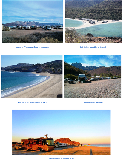
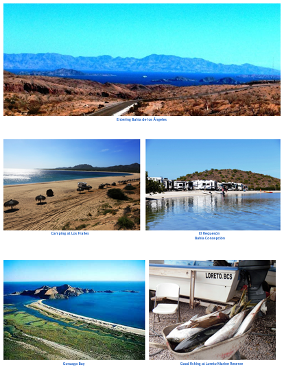
Within a few days of venturing into Baja, our first coastal stay was in Bahía de los Ángeles, where we fell in love with Mexico and Baja – hook, line and sinker. From there, we made it all the way down to Cabo San Lucas and stayed on the beach until our ferry arrived that took us to Puerto Vallarta in Jalisco.
Since then, we have returned to Baja over 30 times, most of which has been spent camping on the Sea of Cortés in both Baja California and Baja California Sur. In addition, we have had the opportunity to enjoy the Sea of Cortés mainland shore in Sonora and Sinaloa.
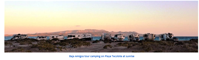
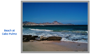
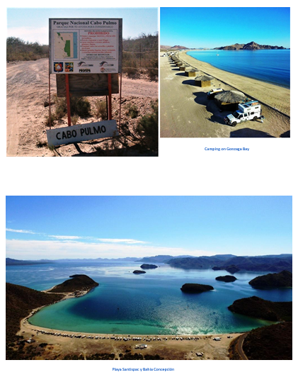
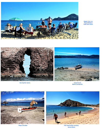
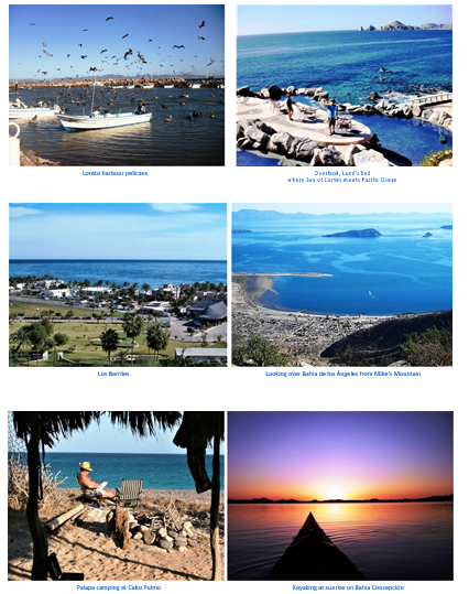
Sadly, the last seaside campground, Brisa del Mar, in Los Cabos, closed in 2006, and there are few RV spaces left anywhere in Cabo San Lucas, San José del Cabo or anywhere in between. We are pleased to report many camping spots still exist south of La Paz including Cabo Pulmo, Bahía Los Frailes, La Venta, Los Barriles and Playa Tecolote, some with services. Many are dry camping sites.
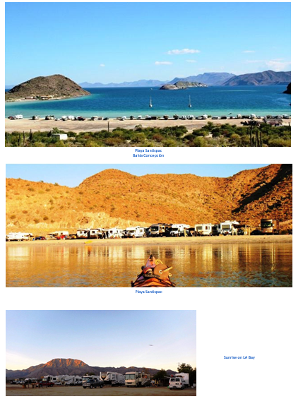
Farther north, there are plenty of locations available in Bahía Concepción, south of Mulegé and also 30 minutes north at San Lucas Cove. There are still a few, some more elusive than others, in the Loreto and Puerto Escondido area. Bahía de los Ángeles remains one of our favourite spots, especially for fishing.
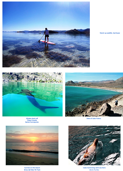
For us, swimming, snorkeling, kayaking and paddle boarding has always been routine at these stops, when the winds are calm and the water warm. Many of these locations are on our Baja RV tour itineraries, which now includes Bahía San Luis Gonzaga since Hwy 5 was completed and paved from Hwy 1.
History
The Sea of Cortés, named after the Spanish conquistador Hernán Cortés, is the 700-mile-long body of water embraced by mainland Mexico and Baja California. Some of the first charts, drawn in the early 1500s, depicted Baja as an island. This was disproven in 1539 by Francisco de Ulloa, who was sent by Hernán Cortés to explore the area.
Cortés had heard persistent rumors that there was an island ruled by Amazon women with weapons made of gold and that the surrounding waters were paved with endless beds of pearls. Ulloa named the sea after his benefactor.
 The Pacific Plate once moved northwest off Mexico’s west coast and the Sea of Cortés did not exist. Over several million years, the plate movement slowly rotated counter clockwise and produced incredible stresses upon western Mexico. This, eventually, moved the fault line eastward, slowly ripping off Baja California.
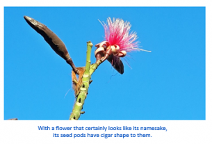
The peninsula lifted along the west side of the newly forming gulf. There is a dramatic view of this escarpment of mountains above the town of Loreto. Farther north, we know this fault as San Andreas. You do not have to look much further than some unique plant species found only on Baja, adjacent to the main-land in Sonora. In time, Baja and western California is heading out to the pacific.
 Known for fishing worldwide
Sea of Cortés is legendary for its commercial catch, even though it no longer has a major freshwater input of nutrients from the Colorado River that was significantly damned in the US almost a hundred years ago. How can that be, you ask? The answer lies within its unique oceanography.
In the south, the ocean filled the growing basin to create the youngest gulf in the world. It now has a remarkable depth of over 2 miles at its mouth. Much of its width is over 80 miles across. This basin holds an incredible amount of water. Tides from the rise and fall of the Pacific Ocean pour in and rush out in a massive movement. The water mixes to a depth of 1,500 feet and causes a continuous clockwise current of 0.67 mph around the gulf in winter and a counter clockwise current in summer.
The northern end has a 32-foot tidal range, the third largest in North America. Wind-induced currents also cause major movements of water during the winter. The wind drives the water at 3% of the wind speed and transfers as much as 40% of its energy.
When water moves away from an island or coastline, it is re-placed by water from below in a process called upwelling, most evident in the channel between Bahía de los Ángeles and Isla Ángel de la Guarda. All this water moving around in the gulf brings up not only deeper water, but large amounts of nutrients as well. All you need is an energy source of plentiful sun-light and ‘voila,’ productivity enough to grow a crop of phytoplankton that might turn the water red.
The Sea of Cortés has been called the Vermilion Sea. Biologically speaking, the Sea of Cortés is the richest body of water on our entire planet. This diverse sea supports more than 900 varieties of fish and more than 2,000 species of marine invertebrates and is home to species that exist only within its waters.
The sea is abundant with game fish, both small and large, and an extraordinary amount of world record fish have been taken in these waters. Several species of whales regularly visit the sea and the Whale Shark, which is the world’s largest fish, is quite common as far north as our beloved Bahía de los Ángeles.
The soup of phytoplankton feeds invertebrates that are gobbled up by more than 800 kinds of vertebrates including fish,blue and fin whales. The fish are consumed by people, birds, dolphins, porpoises, sea lions, sperm whales, humpbacks, and Bryde’s whales to mention just a few.
There are also over 550 fin whales that are residents in the Sea of Cortés all year. It’s also one of the best places in the world to see blue whales in February and March, best from Loreto.
Islands
 The gulf contains 37 major islands – the two largest being Isla Ángel de la Guarda and Isla Tiburón. Many have their own stories. Native people were active here and traveled by rafts made of aquatic bulrushes called tules. Archaeological sites are com-mon on a number of the islands.
Stone flakes, piles of discarded shells and signs of habitation provide evidence of early people found here long before European contact. Few islands have a reliable source of water, however, so they haven’t felt the heavy hand of modern man.
Biologists working on how plants and animals become established where they are find the perfect laboratory within these islands.
There is enough variation in island histories, ages, locations and topography to test and form theories about island biogeography.
Most of the islands are found on the west side of the gulf. In fact, many of the islands of the gulf are the result of volcanic eruptions that occurred during the early history of Baja California. The islands of Islas Marías, Islas San Francisco, and Isla Partida are thought to be the result of such eruptions. The formations of the islands, however, are not dependent on each other. They were each formed as a result of an individual structural occurrence.
Several islands, including Isla Coronado, are home to volcanoes. The gulf has more than 900 islets and islands that together total about 420 hectares. All of them, as a whole, were enacted as “Area Reserve and Migratory Bird Refuge and Wildlife” on Au-gust 2, 1978. In June 2000, the islands were designated a flora and fauna protection area.
In addition to this effort by the Mexican government, for its importance and recognition worldwide, all islands in the gulf are also part of the international program “Man and Bio sphere” (MAB) and are part of the World Reserve Network UNESCO Biosphere as Special Biosphere Reserve. Because of the vast expanse covered by this federal protected area, conservation and management is carried out through a system of four regional directorates (one per area bordering the Gulf of California state).
The work of direct and indirect conservation done in the islands is governed by a single management program, published in 2000, which is complemented by local and specific management programs. The Directorate of Protection Area Wildlife California Gulf Islands in Baja California is responsible for 56 is-lands located off the coast of the state. These are grouped into four archipelagos: San Luis Gonzaga or Enchanted, Guardian Angel, Bahia de los Angeles and San Lorenzo.
These are some of the reasons why people who love whales, dolphins, seabirds and desert environments take vacations by land or small cruise ship to visit this unpopulated and exciting sea next to the Baja California Peninsula in Mexico.
What are yours?
 |
 |
 |
 |
 |
 |
 |
 |
Dan and Lisa Goy, owners of Baja Amigos RV Caravan Tours, have been making Mexico their second home for more than 30 years and love to introduce Mexico to newcomers.