By John Chalmers from the May 2017 Edition
A day trip by car from the Manzanillo area to see nearby
towns, beaches and scenery is a fine way to enjoy the country. A scheduled group tour for a few days has someone else do all the planning, driving and arranging accommodation. Both car and bus trips, sometimes combined with air travel, have helped us become acquainted with México and its history.
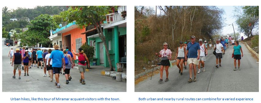
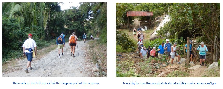
For something completely different, hikes with fellow visitors on several of the routes in the Manzanillo area 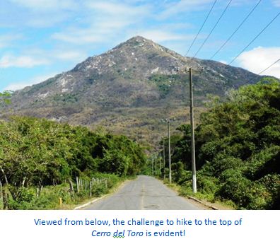 provide a so- cial experience, great exercise and a chance to appreciate sights not seen when travelling by car, bus or airplane!
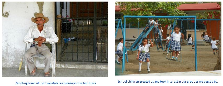
Most hikers in our groups are Americans or Canadians enjoying the climate of México without having to bundle up and shovel snow which they might be doing if they had stayed home. We have numbered from 10 to 40 hikers on our jaunts, always pleased to have some of our Mexican friends join us.
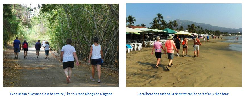
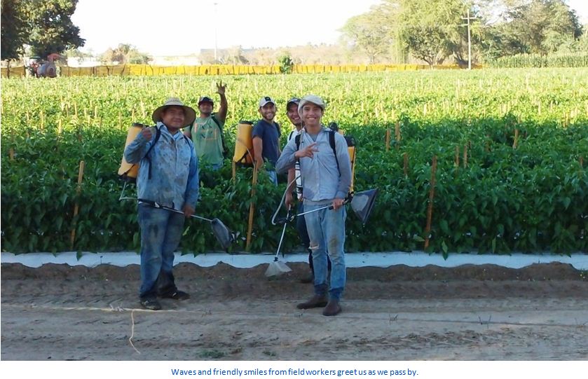
Our hikes have taken us on several routes. From Highway 200 west of Manzanillo we have hiked out to wide expanses of the Pacific beach. Another route in the area has taken us up roads on hills to undeveloped areas and remote sites that are populated with only a few homes.
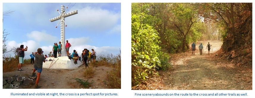
Closer to Manzanillo, the hills – or should they be called mountains? – provide access to viewpoints of  panoramic vistas of the sea and El Centro. From the starting point near the downtown area, on one trek, we took the trail that ends with 225 steep steps, culminating at the cross overlooking Manzanillo from atop the mountain with a view of the city and the port.
Starting from the same point, but hiking up a paved road in- stead, the route ends at the Manzanillo lighthouse. Like the hike to the cross, the reward is a fine view of the area, including the city, the sea, ships, the power plant and the port.
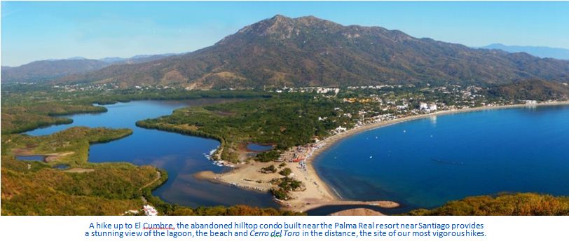
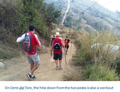
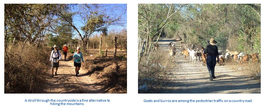
For a truly vigorous hike, the trek up the road to the communications towers atop Cerro del Toro is a fine test of fitness. From the starting point near the town of La Central, it takes roughly two hours, if you are in shape, and nearly as long coming down. Hiking poles, good footwear and lots of water are neces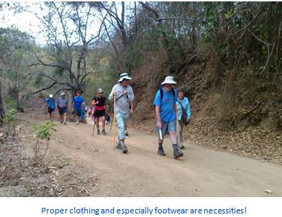 sities on vigorous treks and a camera will record your experience to share with friends.
One route proved so popular that we hiked it three times. It is area. The trip provided close-up views of agriculture in the area. We walked past perfectly groomed fields of green pep- pers, red peppers, tomatillos, tomatoes, corn and bananas. Live- stock we saw on the route included cattle, goats, burros and donkeys. Fields of agave and prickly-pear cactus added to the variety.
That particular hike began in the area north of Santiago and continued for some 12 kilometers in a route that was scenic and often shaded, providing a fine start to the day, with the companionship of fellow visitors who share a love of México.
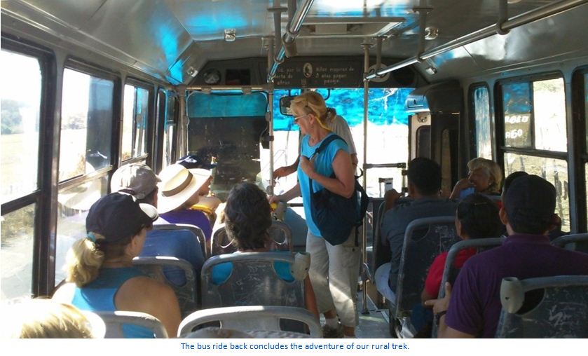
The route ends at a paved road where we flag down a local bus for the ride back to our starting point. Past the penitentiary and through new housing districts, the 7-peso ride ends where we began. A cold cerveza then provides a fine way to toast the experience and the companionship of fellow hikers. With the great weather in the Manzanillo area, any day is a good day for a level path on rural roads through farmland in the Manzanillo a hike — Viva México!
Download the full edition or view it online