By Dan and Lisa Goy from the August 2018 Edition
January 19 and 20, 2016 (Day 13 – 14) Isla Aguada, Campeche
We headed out early, led by Rafael and Eileen. Our 6:37 am departure was our attempt to avoid Villahermosa road construc-tion in rush hour traffic. This strategy worked well as we whis-tled through town on our way to Hwy 180 and Isla Aguada. On the road, we first encountered Frontera, Tabasco, then crossed the border to the much larger Ciudad del Carmen, Campeche. The GPS took the caravan through an urban route in Ciudad del Carmen that gave us real insight into local Mexican life, always interesting. The two bridges en route were very impres-sive, first Puente Zacatal southbound into Ciudad del Carmen, then Puente Unidad before we arrived in Isla Aguada. The Freedom Shores Resort and RV Park was a short distance from the Hwy 180 and easy to find. We were set up by noon.
Two Class A motorhomes from Quebec were in the campground when we arrived. We all had spaces on the la-goon. We met with the owner, Thelma, who informed us that the rate was now $30 USD although everything we had read said $20 USD. This was a harbinger of things to come. The park advertised full services including Wi-Fi. Although we asked mul-tiple times for an access code, we were never provided one, just lame excuses. Access to Thelma was also an issue. In the 60 hours of so we were there, we saw her 3 times for maybe 30 minutes, otherwise the cleaning staff told us she was out. We were told we could fill our RV tanks with water but could not actually hook up. To add insult to injury, there was a very an-noying alarm next to the park apparently to keep birds off a hydro tower. This started a dusk and went on until about mid-morning each day.
Late on the second day, I sat down with Thelma and attempted to negotiate a better rate for an extra day given our litany of complaints. That did not go well and, after two nights, we departed. Having said all that, we made the best of our stay on the beach, swimming, on the SUP and working on our tans. The Quebecers left for Ciudad Campeche the second day and we went for walk in town, such as it is. Some went to the Light-house Museo and all of us headed off to the Zazil-Ha Restaurante for dinner, tasty and priced right. We even tried a 3-wheel taxi, at 8 pesos per person, around town, very practical and fun…another new experience. I do not think we will be re-turning to Isla Aguada. The folks were very friendly, however the town really was not much and the campground was expensive.


The full name of Isla Aguada is La Villa de Aguada Island, located at the western end of the Peninsula del Palmar, in front of the coastline of Ciudad Del Carmen. Originally known by Chontal Maya, this small island was called Isla Value by the Spaniards. At the time the island was largely uninhabited, used occasionally as a place of shelter for boaters in hurricane season. Following persistent pirate attacks in 1762, the governor, Bernardo Sáenz Montero, sent a detachment of well-armed men in two ships, which took the thieves by surprise, recovered goods and took prisoners. Later, the governor built a small fort and a watchtower, and the first permanent residents of Isla Aguada came. In 1824, shortly after independence from Spain, José María Castro was appointed to Isla Aguada as an auxiliary judge. During the Caste War of Yucatan, the population in-creased dramatically, as many families found sanctuary in Isla Aguada. On October 25, 1923, the President of Mexico estab-lished an Ejido for the local population.

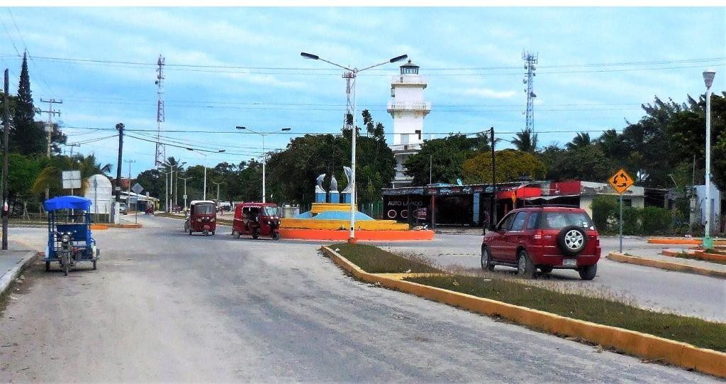
Isla Aguada Lighthouse
The old lighthouse is an architectural gem, dating from the times of Porfirio Diaz, circa 1907. On orders of Porfirio Diaz, the lighthouse was designed by French architects and was part of a series of seven lighthouses that were distributed in the states of Tamaulipas, Veracruz, Campeche and Yucatan. The masonry construction building is of architectural French neoclassical style and known as Punta del Tigre (named after local Ocelots and Jaguars).
The bronze dome on the lighthouse was manufactured in the ‘City of Light’, by the Barbiere Bernard and Torenne Company,
in Paris, France, transported by boat from the old continent to Mexico. Unfortunately, the bronze structure disappeared in 1978, as did the last lighthouse keeper Eleazar Fuentes Sergio Arce. The restoration of the lighthouse by the Government of the State of Campeche and by the Port Authority in 2010 exceeded over nine million pesos. The old lighthouse of Aguada
Island has now become a Community Cultural Center, where the first floor rooms are now the Community Museum. Here, the first room hosts exhibitions and the second-floor is dedicated to the exhibition of rescued wrecks sponsored by the Underwater Archaeology Program, in collaboration with the National Institute of Anthropology and History.

Laguna de Términos was discovered during Juan de Grijalva’s expedition in 1518 and is the largest, and one of the biologically richest tidal lagoons located entirely on the Gulf Coast of Mexico. Exchanging water with several rivers and lagoons, the Laguna is part of the most important hydrographic river basin in Mexico. It is important commercially, as well as ecologically, by serving as a refuge for an extensive number of flora and fauna; its mangroves provide an important role as a refuge for
migratory birds.
Términos Lagoon is made up of a series of rich, sediment laden lagoons and tidal estuaries connected by two channels to the Bay of Campeche in the southern part of Gulf of Mexico, in Carmen Municipality in the southwestern part of the Mexican state of Campeche. Its shores are swampy and support man-groves. It is fed by several freshwater rivers, including the Mez-capala, Grijalva and Usumacinta Rivers, and includes several la-goons such as Pom, Atasta, Puerto Rico, Este and Panlau. It is 72 km (45 mi) long, 24 km (15 mi) wide, and covers an area of 1,550 km2 (600 sq mi). Every nine days, approximately 50% of the lagoon’s water volume is renewed, primarily through the effect of ocean tides. On the surrounding barrier islands, beach ridges and mangrove coastline, there are several Late Postclas-sic Maya sites. The city of Ciudad del Carmen is located on Isla del Carmen, between the lagoon and the Bay of Campeche.
Twenty-nine percent of the lagoon is covered with seagrass. The lagoon was designated as a federally protected area for flora and fauna in 1994 by the Mexican government because of the importance of the biological ecosystems provided by its es-tuaries. There have been 1,468 identified fauna species found within the protected area of Laguna de Términos; 30 species are endemic to Mexico and 89 are threatened; 132 species are considered to be commercially important. There are 279 bird, 74 insect (considered an incomplete listing) and 34 mammal species identified and at least 367 species of fish. Of about 134 mammalian species from 27 families present in the area, rare and endangered species include felines (Jaguar, Ocelot, Mar-gay), primates (Geoffroy’s Spider Monkey), and marine mam-mals including Cetaceans and the West Indian Manatee.

Bottlenose Dolphins (Tursiops truncatus) are known to visit the lagoon regularly, but their safety could be endangered due to several artificial factors. A conservation group called Instituto Via Delphi, which is specially designed for protection of local dolphins along Mexican gulf regions, were founded to focus understanding of biology of these dolphins and to strengthen their protection. The biggest influence on the area, and a possible threat, are the operations of state-owned oil company,

Pemex, operating within the protected area. The drilling of oil wells and the construction of pipelines can destroy habitat. Additionally, oil spills are a continual threat. Other possible threats include habitat change through population growth in the surrounding area. Laguna de Términos Flora and Fauna Protection Area as a whole is considered to be critically threatened. Local populations of crocodiles and sea turtles in the areas are in serious danger due to their value for commercial industries.
The Zacatal Bridge is located southwest of Ciudad del Carmen, in the state of Campeche in Mexico. It connects the Atasta peninsula and the Isla del Carmen, was the longest bridge in the state and, at the time of opening, the longest in Mexico with a length of 3,861 m and a width of 9.00 m. It is a two lane road bridge for the Federal Highway 180. It is one of the busiest in the country since it is the gateway to the Yucatán Peninsula. The superstructure is composed entirely of prefabricated elements to base being: 121 heads of precast concrete, 496 Type IV girders Aastha amended and 8 box girders as well as 124 post tensioned concrete slabs. It was completed in October 1994.
The La Unidad Bridge connects the village of Isla Aguada with Ciudad del Carmen and is vital to the well being and economy of these two towns, as well as to the entire Yucatán peninsula. Nearly 2 miles (3.2 km) long, and built in 1982, the 30-year-old bridge is subjected to an aggressive marine environment and is part of a major highway that runs along the coastline from Tex-as to the tip of the Yucatán peninsula.
A visual inspection of the structure revealed that cracks had penetrated the concrete matrix and corrosion of the reinforcement was present and active. Because the bridge is essential for the community, and any detour would be lengthy, the Mexican federal and local transportation authorities elected to repair it.

Download the full edition or view it online
Dan and Lisa Goy, owners of Baja Amigos RV Caravan Tours, have been making Mexico their second home for more than 30 years and love to introduce Mexico to newcomers.